Showing posts with label hiking. Show all posts

07 February 2024

Post Snow Storm Walk

27 September 2022

30 May 2022

Tracadie Island Beach Walk

26 April 2022

Fredericton to Elliotts on the Confederation Trail


An 8km hike on an extremely windy Sunday.

18 October 2021

Strathgartney Hike

23 February 2021

Winter River hike in the snow.


02 December 2020

Hiking from Route 10 to Borden-Carleton on The Confederation Trail


After yesterday’s rain we were treated to a bright sunny Sunday for our final cross-island hike in this series. We drove to yesterday’s finishing point and parked where route 10 crosses the trail. Within just twenty minutes we were strolling through the Bridge Park at Borden-Carleton and passing the Visitor Centre, plaques, information boards and all the other paraphernalia of a Provincial entry/exit point.
 
The wind was howling and several times I dashed back to retrieve my cap. With a fairly short hike for today, we had plenty of time to wander around and I photographed artefacts left over from the railway era. We climbed the stairs inside the model ferry and stood on the upper deck gazing out over a mercury-grey sea. Not surprisingly, with closure of the Atlantic Travel Bubble, traffic on the Confederation Bridge was very light.
 
We left the Bridge behind and walked back to the trail. Soon we were back at the car and congratulating ourselves on completing this long central stretch of the Confederation Trail, from Charlottetown to Borden-Carleton. We’ll come up with more adventures for next year!

01 December 2020

Hiking from Albany to Route 10 on The Confederation Trail


The penultimate leg of our cross-island hike took us from Albany to the road crossing at Route 6. It was cold with a fine drizzle but surprisingly this was only our second walk in the rain all year. It was also our longest at 11.74 km. We plan to head out tomorrow too and, after today’s effort, we are now left with just a 6km round hike for the final leg which will see us reach the Confederation Bridge at Borden Carleton

24 November 2020

Hiking from Kinkora to Albany on The Confederation Trail

Trekking westwards, we picked up the Trail again at Kinkora. This branch of the old railway runs to the old port of Borden and will eventually bring us to the bridge to the mainland. We had encounters with ATV drivers and a miscellany of disused farming equipment but otherwise the 9km hike was only notable for long straight sections under glorious sunshine.

20 November 2020

Hiking from Emerald Junction to Kinkora


The temperature was barely 2c when we hit the trail last weekend. Nonetheless we kept warm by maintaining a good pace, as you can hear from the rhythmic crunching of our boots! A notable sight along the route was a large collection of truck plow blades and an old wasps nest, which Susan carefully prized apart. The living quarters were incredibly intricate and contained hints of what once lived inside.

11 November 2020

Hiking from Breadalbane to Emerald Junction on The Confederation Trail


Susan was tired after only four hours sleep the night before but insisted she was up for a hike and we completed a round trip of just over 6km, somewhat shorter than our usual jaunts.

This weekend took us from Breadalbane to Emerald Junction. Just before the junction itself, where the line continues west to Kensington and sends a branch line south to Borden Carleton, is the site of the Emerald Junction Station. The station building was saved following closure of the railways and is now home to Bedeque Bay Environmental Association which probably explains a nearby hut with a placard reading Monarch Way Station.

03 November 2020

Hiking from Elliotts to Breadalbane on The Confederation Trail


After a summer of cycling we have switched to hiking and although we rode this section of The Confederation Trail only a few weeks ago it was good to take it more slowly and on foot. When the snow comes the Trail will be handed over to the Snowmobile Association who lease it for the winter months but for now it's ours and today we covered 10 km on it.

The trees lining the Trail rustled and creaked under a stiff wind, while here and there patches of ice from a recent snow flurry lingered and autumn birch leaves like gold coins scurried across our path. The sun shone and the sky was blue, belying the single digit temperature. Bovine and equine company abounded. Some very large cows were curious about us from the start and two placid horses ambled over to greet us near our turnaround point.

Susan regaled me with stories of her childhood and at the start of this film she is heard explaining how they ran barefoot through fields of cow pats (patties over here). I feel as though I haven't lived!

You rather wish that farmer would be made to have his ancient rusted machinery hauled away. It is a blot on the landscape and at one point even encroaches on the shoulder of the Trail. The cows didn't mind though and thoughtfully chewed their cud.


30 October 2020

A neighbourhood walk around Hermitage Creek


The blue sky and sunshine are deceptive. It's 3c and colder days are just around the corner.

29 October 2020

Hiking at Winter River


It was only 6C but deep in the woods at Winter River we weren’t cold at all.

17 November 2019

Cavendish Beach, PEI National Park


This afternoon we drove to PEI National Park on the north shore and walked Cavendish Beach. Our intention had been to park at the empty campground and walk from there but the buzz of chainsaws and the sight of men in hi-viz jackets confirmed the area was closed for cleaning up after last month’s hurricane Dorian.

Cavendish was badly hit with thousands of trees down. Despite its somewhat tired old world charms this remains the epicentre of summer tourism here and starting the mammoth clean-up now will give them a head start before next season. We pulled up our hoods against the strong north westerly wind and walked west with the breakers crashing to our right and sea foam scudding across the wet sand.


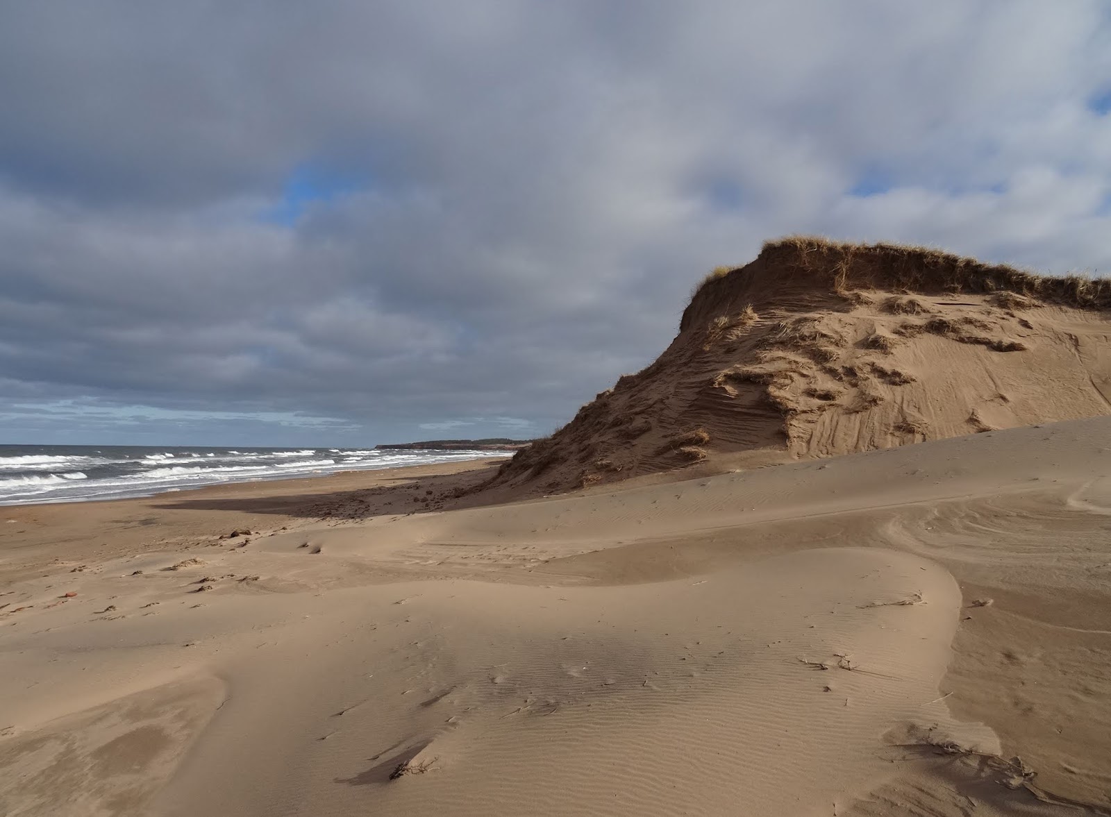
An outflow from Clarkes Pond blocked our route by which time we had almost reached the campground via the beach. Smoke rose from several fires where workers were burning brush and tree trimmings. For a short while we sought shelter from the wind in the lea of towering dunes then Susan scampered wilfully up the side of one. This was quite without damage to the dune as it is covered in thick grass. From the top she called down to announce what a splendid view she had.

Driving back through to Charlottetown via North Rustico we decided to aim for Victoria Park. There we finished our afternoon’s exercise with a stroll up and down the harbour boardwalk before heading home to batten down the hatches and settle in for dinner and movies.

03 September 2019


As a pair of spry old farts we usually look for an adventure of some sort over our weekends, be that beach walking or trail hiking but this time we pushed ourselves to the limit and even beyond.

Some while ago I spied on maps a geographical formation in the east of PEI which I felt deserved closer inspection, Boughton Island, which is actually not quite an island but connected to the shore off Cardigan by a one and a half kilometre, grassy sandbank. The island has been uninhabited since the 1930s but was once home to a small community with farmland and lobster canneries, even a school house and post office. Now the only residents are fox, beaver and a variety of birdlife.

The six hundred acre island contains spruce forest, marshland and ponds and is rimmed in most places with red dirt cliffs ranging from ten to fifty feet high. We encountered all these features on a long and exhausting Sunday afternoon.

After a one hour drive to the east of PEI we found the long dirt track, Bruce Point Road, which leads to the shore where access to the sandbank can be had. Until a few months ago a local resident had installed a gate preventing vehicular access to the shore but resistance and government intervention has seen this removed now.

We parked on dune grass and consulted the GPS for walking directions as the island is not apparent from a ground perspective. Satisfied that we were on a southerly path towards the east side of the sandbank we marched off, the smell of rotting seaweed and exposed mudflats harsh in our nostrils. I took a swift jog back to the car for my cap to protect my jutting forehead (and gaping holes behind) from the sun which was still strong in September!


The sand bank is surprisingly high, maybe fifteen feet, and is at least one hundred meters wide. We found firm, damp sand on the east side and strolled south towards the enticing skyline of red cliffs and fir clad slopes. Piping plovers raced to and fro as low waves surged up the sand then retreated. Just as the sandbank joined the island we passed a middle-aged couple sitting outside a tent. I suspect they were camping overnight and enjoying life “off the grid”. It was somewhat irritating to seek out wilderness only to stumble across people straight away (and these folk were doubtless thinking the same!) however they were to be the first and the last humans we would encounter.

We took a clockwise route around the east of the island on lovely deserted beaches with just the sound of breaking waves and wind in the trees for company. Here and there were tangles of fishing nets, buoys and fenders washed ashore but otherwise the scene was pristine. Cliff erosion had left dead grey tree trunks at rakish angles and many more at the base of the low cliffs, weathered to silver and complete with sea-washed roots. The beach was mostly pink sand but strewn in places with boulders.

Our plan was to walk the shoreline but periodically we scrambled up the loose dirt cliffs to explore however the interior looked deep and impenetrable. At one point we spotted a rope ladder and hauled ourselves up this to find someone had built a small camp with benches, supports for tarps and even a latrine off to the side. We doubted anyone had stayed here this summer and maybe not for a couple of years. There was even a holder with plastic cutlery, nailed to a tree by a makeshift table. We tried to strike west, thinking we might be able to cross the island but there was not a chance. The undergrowth was dense and making any progress would have required a machete. Before we moved on, Susan couldn’t resist a go on a homemade swing at the camp and was soon high out over the cliff edge, swinging into the blue sky!


Regular glances at the GPS map on my phone showed that after an hour of hiking we were close to a flat expanse where we might still be able to head west and cut off the southern tip of the island. It turned out to be a deeply marshy area and we soon abandoned our first course. A possible route to one side, through trees looked passable and after a short, five hundred meter trek we were rewarded with views of the western beach.


Clouds were beginning to gather as we headed slowly west and north along the beach and the cliffs rose to the highest we had yet seen. By mid afternoon we would have taken the opportunity to cut north through the island but the cliffs were dangerously precipitous for climbing so we forged on until the beach ran out. Now we were so far around the island that to turn back would have meant a very long hike so, somewhat dubiously we pressed ahead clambering over huge boulders that had tumbled into the sea.

The inevitable happened and my foot was soaked by a rising wave! Soon we both had to take off our shoes and socks as the only way ahead was to wade. We made it around a jutting sandstone headland and almost immediately I fell, protecting my camera as best I could but landing heavily on one knee and both elbows. Some of the fun was beginning to ebb away but we couldn’t turn around now, time would tell whether this was to be a wise decision.


I had studied the tide charts in advance and knew that the tide would still ebb until 5:30pm so despite seeing waves crash directly onto the rocky shore ahead I felt we should still be able to make it back around to the north shoreline. And so we did, eventually. We both fell and our spirits were lowering. At long last the wet and heavy going of the boulder strewn shore gave way to soft sand and we turned north and east and could at last aim for the western side of the sandbank on the horizon.

But there was to be a sting in the tail...

We plodded over a sand and mud beach, avoiding the worst parts until it became clear we were on sticky mudflats. At that point we tried to head for the tree line and higher ground but it was too late. My feet sank in over my shoes to my shins and when I tried to pull one out I felt a slight panic. It wouldn’t come easily but when it did there was a sucking sound before I had to plant it again to avoid falling over. My shoes and socks were dragged off by the deep mud and I stuck my hand in to retrieve them, then staggered and swore my way to firmer ground. Susan was already fifty yards ahead trudging away disconsolately. The sight of a bald eagle swooping from the tree line to the shore was barely sufficient to raise the mood today.

The island would still not release us from misery as we found one more stretch of marshland to negotiate before reaching the sand bank. It was with quite a sigh that we reached the sandbank beach and turned north towards the PEI mainland. We finally reached the car after close to eleven kilometres and three and a half hours of tough trekking, hungry, sore, wet and exhausted.

14 July 2019

Brookvale Demonstration Woodlot Hike

After a morning of baking, crosswords and The British Formula 1 Grand Prix, we ate a lunch of toasted tuna sandwiches and drove out to Brookvale. In the woods opposite the ski slopes are numerous plantations of specific trees, hardwood and softwood, firs and deciduous. The areas are all labelled and give the planting date, many reaching back to the 1960s.

In January we had snowshoed from the road after climbing the snowbank but this time we could drive half a kilometre up a dirt road to the small and deserted, grassy parking lot.

A number of start and finish points are signed and, following a quick glance at the GPS and liberal squirts of insect repellent, we set off north into the trees.

On a 26c day we were immediately grateful for the shade. We looked left and right at the various woodlot signs (tree identification made easy) and kept an eye out for the gnarled exposed tree roots which had been under a couple of feet of snow and ice the last time we were here. A number of patches of wild mushrooms, blueberries and strawberries grew in areas of sunlight. Here and there we saw insect traps which, we read, are set in order to assess what beneficial insects are attracted, and also what threats.

After a shortish but rather hilly hike of under three kilometres we were back at the car in a little over an hour.